 Satellite
Image Weather Reports
Satellite
Image Weather ReportsUK/EUROPE/WORLD
| Satellite
Image Weather Reports UK/EUROPE/WORLD |
|
Latest Images Meteosat Menu |
|
![]() OR . . .
OR . . .

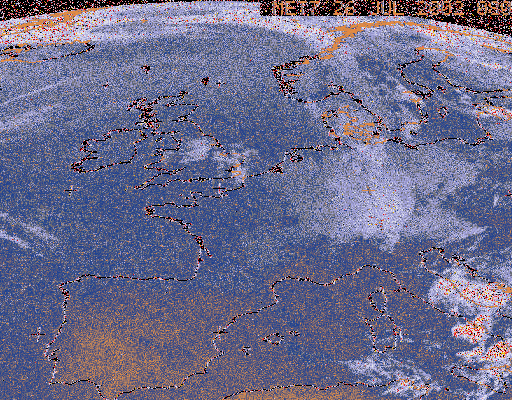
 http://www.meteo.fr/tpsreel/images/satt0.jpg
 http://www.tsc.upna.es/Meteosat/Meteosat_en.html
http://www.meteo.fr:80/tpsreel/e_tpsre.html
http://diana.ecs.soton.ac.uk/~pm/Weather/Meteosat/
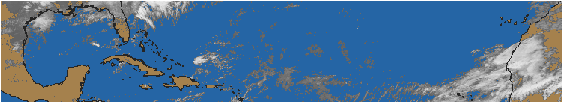
 ftp://ftp.images.met.reading.ac.uk/pub/images/wam/atl/gif/latest.gif
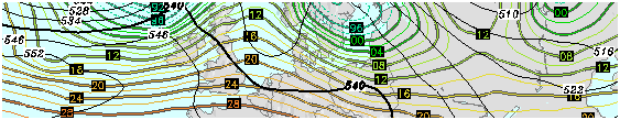
http://www.uni-koeln.de/math-nat-fak/geomet/meteo/winfos/wetterkarten.htm
http://www.uni-koeln.de/math-nat-fak/geomet/meteo/winfos/wetterkarten.htm#B01
http://www.meteoconsult.fr/us/etranger/PhotoSat-to.html